
V-Alert
Real-Time Business & Risk Management
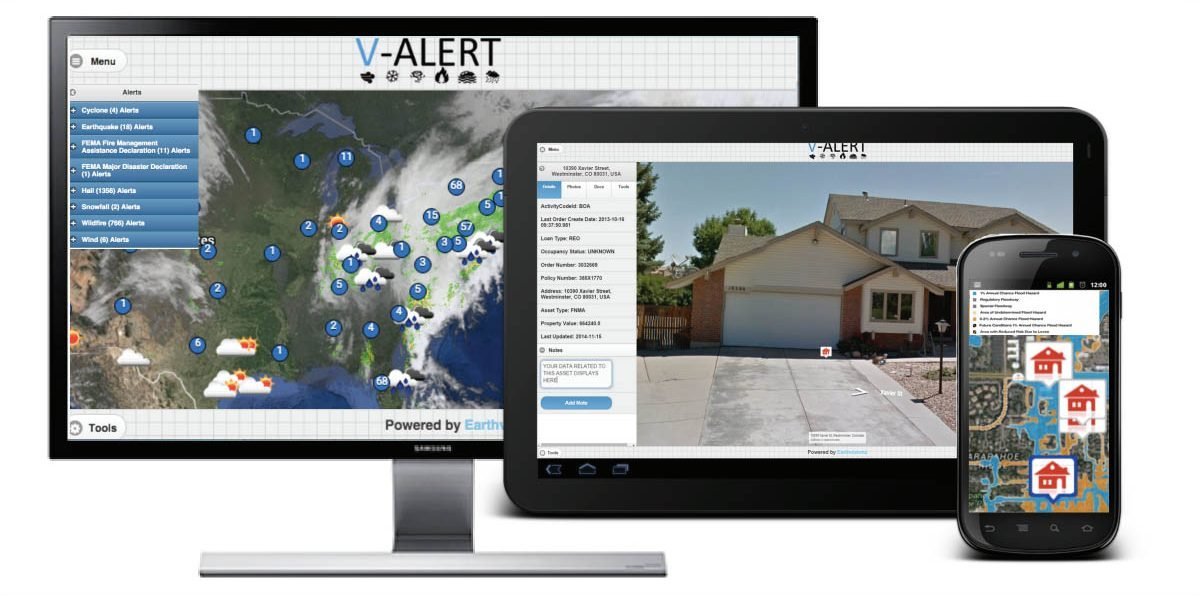
V-Alert is a turnkey solution to manage risk from severe weather or man-made disasters. We map your asset inventories and tag your critical data to each location. All potential threats are visualized on the map command center. V-Alert picks up data from thousands of public and private sources including FEMA, NOAA, National Weather Service, and Inciweb. V-Alert is an automated alerting system with views of your properties delivered right in the alert for fast decision support.

Live Severe Weather & Disaster Alerts
V-Alert pushes alerts for disaster and weather events threatening your locations using the most accurate and up-to-date data feeds. Get alerts on what you want, how you want:
Chose from over 130+ alert types
Push notifications by email or SMS
Receive reports every 6hrs, 12hrs or 24hrs for current and forecasted events
Alerts are matched to your assets at a sub zip code level
Regulatory and compliance (EPA, State, Local) data imbedded in alerts
Alerts sent to any and only desired recipients
Customize alerts by user, location type, and more
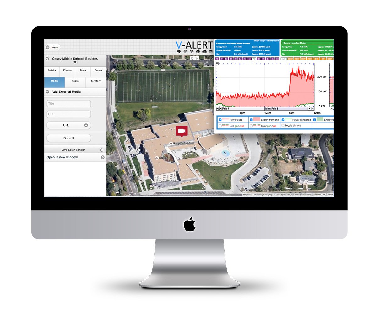
Geospatial Data Management
V-Alert aggregates, organizes, and makes all desired data searchable: bulk data uploading, address verification, and data tagging for millions of locations in one simple step:
Attach any desired data to any location including scanned documents, spreadsheets, charts, and more
Overlay high-resolution areal photographs and map archives including ESRI, floodplain, environmental contamination, and more
Easily customize access rights by the user to adjust what each can see and do
API can centralize and integrate any and all desired data
Real-Time Visual Monitoring
Tasked teams quickly and efficiently with real-time visual validation:
See all at risk assets inside alert boundaries on the map and select any to view its site-specific data
Overlay near real-time imagery to see current weather conditions and severity with assets in view
Link to street cams, video feeds and sensor networks to any uploaded location
Instantly upload videos, date-stamped images, 360 degree panos and more
Zoom in for visual verification and to view surrounding terrain with street view and satellite maps accessing drone imagery
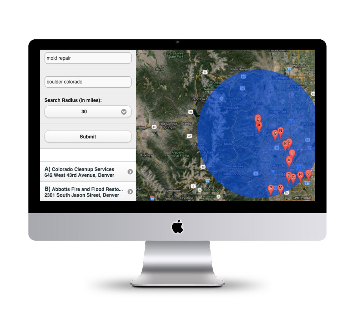
Improve Operations
V-Alert makes property and facilities management fast and easy.
Easily forward lists of affected assets with location and information for response and repair
Mobilize resources quickly and efficiently
Task inspectors and contractors
Inform maintenance personnel and suppliers
Prepare site managers and clients
Collaborate and share data in real time with insurance claims, underwriting and financial institutions
Increase sales with your own branded command center