


Round-The-Clock Monitoring of Your Assets with Real-Time Alerts and Sensor Data
All the Data, Imagery, and Decision-Support you Need in one Application
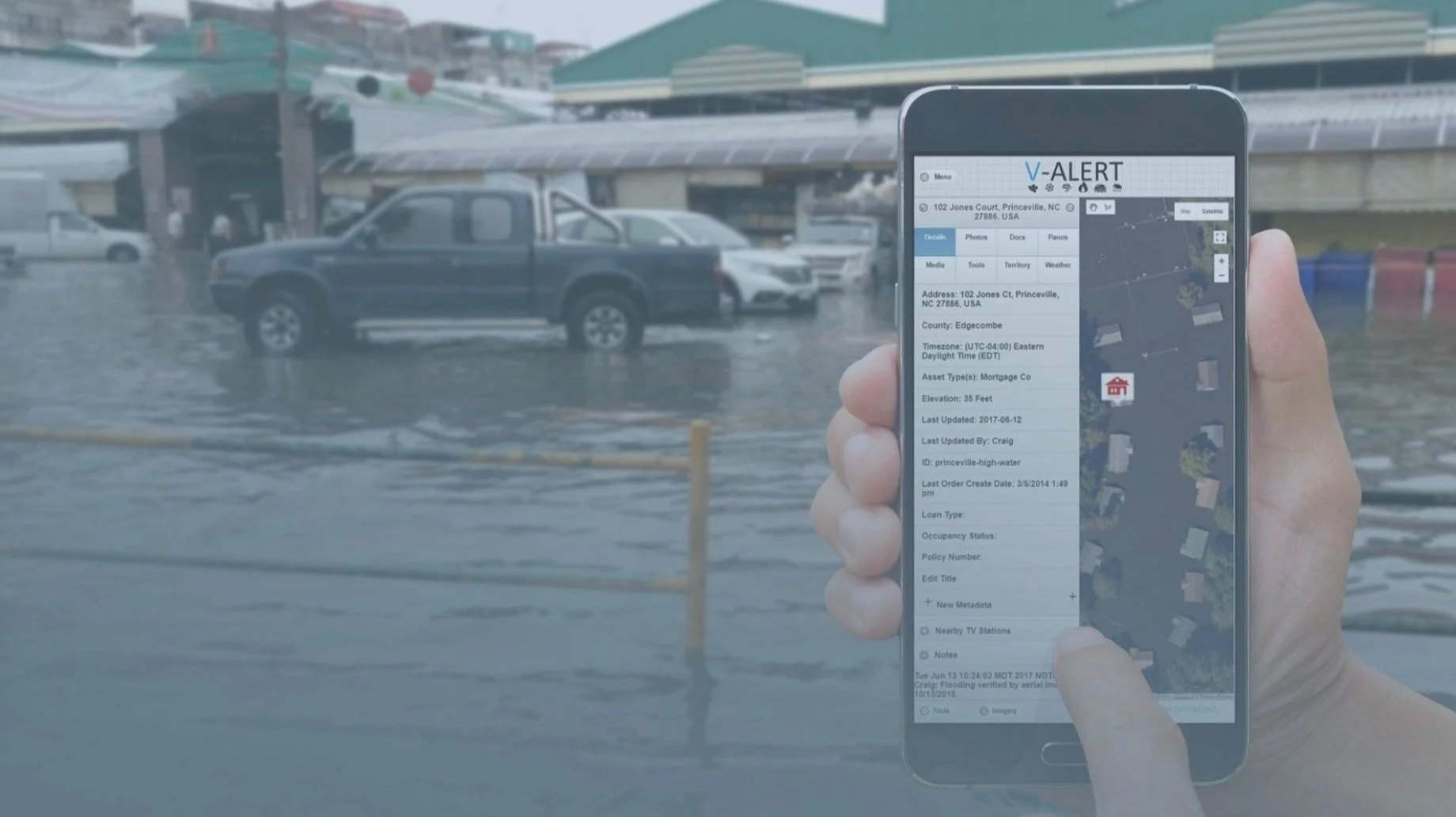
Map Property Inventories with Data
Upload and map all properties you are concerned about with property data tagged to each location.
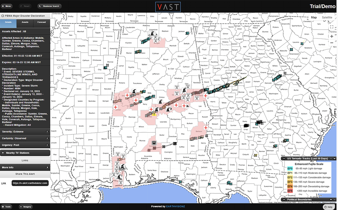
See All Threats on Your Customized Live Map
Threats to your properties visualized on the map command center using polygons and shape files.

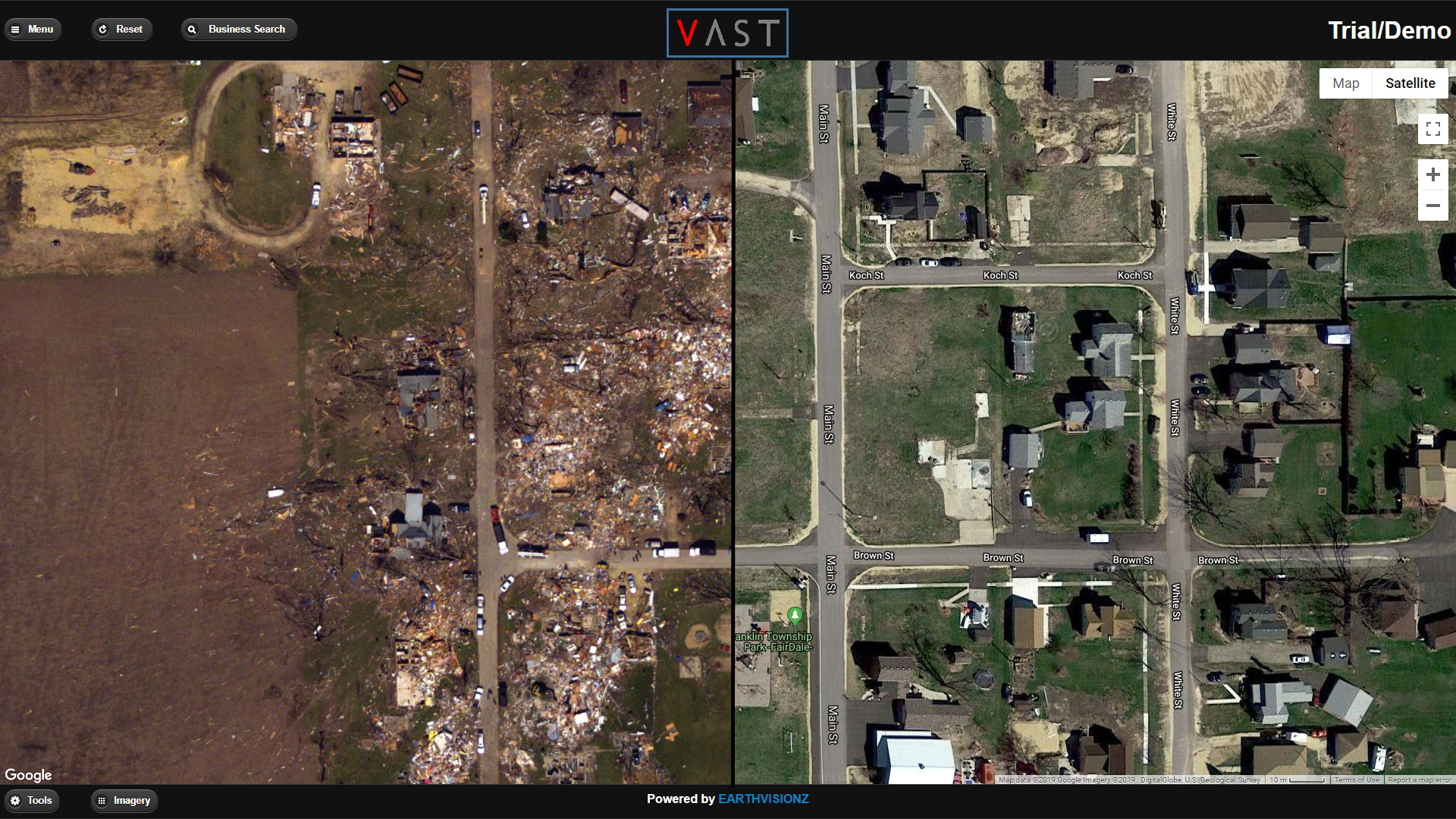
Overlay Real-Time Satellite Imagery
Satellite imagery overlays help you assess damage once the storm has passed.
Send Alerts to Your Customers & Vendors
Earthvisionz aggregates data from thousands of gauges and alerts you about events damaging your properties 24/7.

Trusted by Industry Leaders
Automated solution for critical event management. Map your property inventories, authenticate users to get alerts, and see whats threatening your properties 24/7.


We also provide IoT data visualization services for the following sectors:
Government | Architecture & Engineering | Telecommunications | Smart Cities
Our Products
Live Alerts. Big Data. Real-Time Visualization


Simplify Business Operations
Real-time critical information, all in one place
Manage supply chain disruptions by seeing dangerous events on the map

Automated alerts for all assets you need to know about gives you peace of mind

Alerts can be customized to include your messaging and branding

Visualize data from live cams and sensors on your properties for decision support

Regulatory data from governments agencies helps you respond where fines and lawsuits are a concern

Help ensure public safety for your employees, customers and the communities they serve

Easy to use, turn-key solution

Tag critical response and recovery data to any asset to help responders show up prepared


Up & Running in 24 Hours!
Quick and easy installation means you can be operational fast!


Customer Testimonials
“First of its Kind”
I worked with Carla, Jeff and the entire Earthvisionz team for over 6 years while I was leading digital product development efforts at the PGA Tour. We engaged with them to build out the first ever “live map” experience integrating information about fixed points of interest throughout tournament venues along with the PGA Tour’s Shotlink scoring data for tracking live player location at over 40 events. It was a first of its kind effort and the Earthvisionz team hit a home run on all fronts - design, implementation, support, and just the overall working relationship with over 2M users.
D. Plant, PGA Tour Director of Product Development, 2007-2019
“Most Accurate Geo-coding Alert System”
It’s easy, fast, and accurate…really. V-Alert is the fastest and most accurate geo-coding and alerting system I have ever used. We have greatly increased our snow removal work orders and added many clients. We use it every day.
S. Preble, CTO, LPS
“Quickly Pool Resources for Response”
Earthvisionz provides real-time weather information and communication for ATI and more importantly our clients. ATI is able to quickly pool resources for response knowing exactly what client assets may be affected while our clients can engage their disaster recovery plan to mitigate loss. The partnership created by Earthvisionz is critical to the process.
T. Mette, ATI