Santa Ana Winds Fuel Destructive Wildfires in Los Angeles
Southern California is once again under siege from fast-moving wildfires, with four blazes currently burning across Los Angeles County. At least two people have been killed, more than 1,000 structures destroyed, and thousands of residents forced to evacuate. The largest, known as the Palisades Fire, has grown to just over 11,000 acres and growing with zero containment, threatening over 10,000 homes. Meanwhile, three additional fires—Eaton, Hurst, and Woodley—are also raging, each bringing new threats and evacuation orders.

Map of Fires and road closures in/around Los Angeles, California. (1/8/25)
Why the Santa Ana Winds Are So Dangerous
A significant factor fueling these dangerous conditions are the Santa Ana winds, sometimes referred to as the “devil wind” or “red wind.” These are powerful, dry winds that typically occur from late September to May. Their origin lies in the Great Basin, a high-pressure region stretching across parts of Nevada, Utah, Idaho, and Oregon. As the air flows south and west toward the Southern California coast, it descends over mountainous terrain and funnels through narrow canyons and valleys, picking up speed and losing even more moisture.
Key characteristics of Santa Ana winds include:
Intensity: Wind speeds can frequently top 80 mph (130 km/h), with gusts reaching 100 mph (160 km/h) in the worst events.
Dryness: The desert source of the air combined with its descent down the mountains results in very low humidity, effectively stripping vegetation of moisture.
Fire Propagation: Once a fire begins, these strong, dry winds can spread flames incredibly fast, often making them difficult—and sometimes impossible—to contain.

Wind Speed Map in/around Los Angeles, California. (1/8/25)
Looking Ahead
While crews from the Los Angeles County Fire Department, CalFire, and other agencies are working around the clock to contain these blazes, officials warn that the threat remains high as long as the Santa Ana winds persist. Governor Newsom’s declaration of a state of emergency and the FEMA grant funding will bring much-needed assistance, but for now, the focus remains on saving lives, securing property, and controlling the fires.
In an emergency situation like this, timely and accurate information can mean the difference between chaos and safety. Earthvisionz offers advanced mapping and data visualization tools that help you stay on top of rapidly changing fire conditions, monitor shifting weather patterns, and access critical information in real time. With customizable alerts, live updates, and in-depth reporting features, Earthvisionz empowers communities and businesses to make informed decisions—both during the crisis and throughout the recovery process.
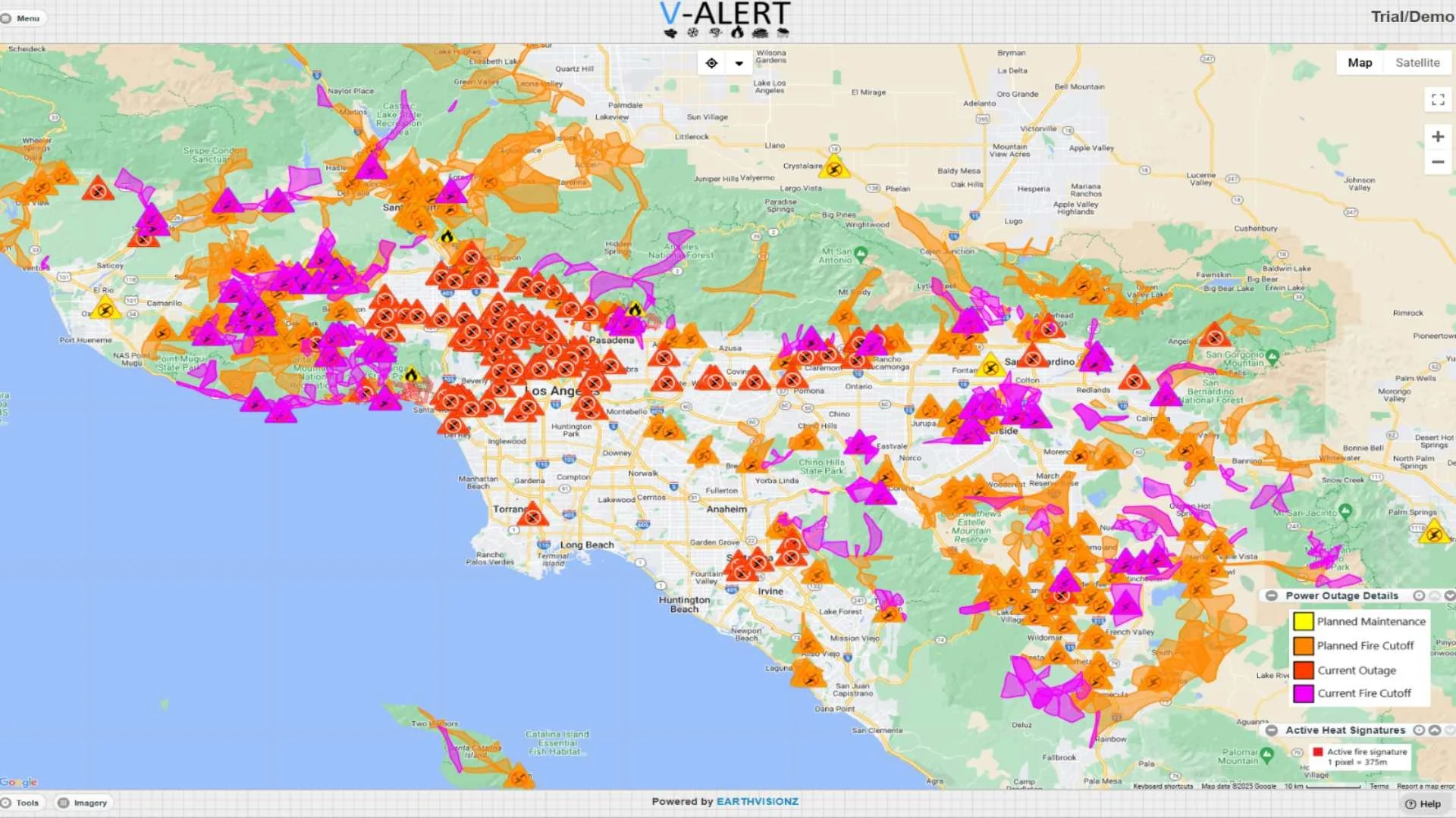
Map of Power outages in/around Los Angeles, California. (1/8/25)